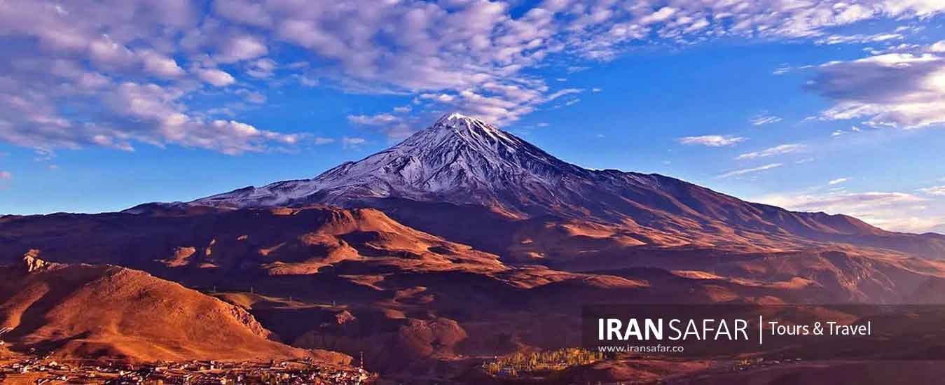
Located in the central part of Alborz mountain range, Mt Damavand (5610 m) is the most prominent natural feature of Iran looming majestically near the southern coast of the Caspian Sea. In terms of national divisions, the peak is located in Larijan county of Amol city, Mazandaran province. It can be seen from the cities of Tehran, Varamin, Qom, as well as the Caspian Sea coast when the sky is clear and sunny.
Damavand is a dormant volcano with an iced-caped summit crater (400 m in diameter) that erupted for the last time 38,500 years ago, and it may happen again. It is the highest peak of Iran and Middle East and the highest if you travel from Europe eastward to Iran.
Mount Damavand was registered as the first natural monument of Iran on July 20, 2008. It is worth mentioning that this mountain was considered as a national natural monument in 2002 among four valuable areas in terms of environmental protection. Damavand can be easily reached via Haraz Road from Tehran.
Mt Damavand is visible far from 250km in a clear sky. Just below its crater there are few famous glaciers such as “Yakhar”and “Sioleh”. There are some hot springs on its lower slopes in Larijan county. Because of its great height, the view from top is very extensive, a big panorama of mountains and valley covering some hundreds of square Kilometers. All around are other peaks of the Alborz Mountain Range, in the north to the Caspian Sea plain and in the south descending to the deserts of central Iran.
Damavand Volcano
Damavand is a semi-active volcanic mountain that was formed during the fourth geological epoch called the Holocene and its lifespan is estimated at least 38,500 years using the carbon 14 method. The presence of several sulfur springs is evidence of the semi-activity of this volcano. Most of the volcanic activity that led to the formation of this mountain occurred about 10,000 years ago. The diameter of the crater is about 400 meters, which is covered by a lake of ice.
Some believe that Damavand is not volcanic. But others believe that Damavand volcano is active and the outflow of gas and hot springs is a sign of its activity.
The rivers around Mount Damavand
Around Damavand, there are five rivers. Haraz River in the south and east of Damavand Mountain, Lar River and Div Asiab River in the west, Panj Aab in the east and Tineh River are located in the north of this high mountain.
Damavand Thermal Springs
Damavand Thermal springs are mainly located on the volcano’s sides and at the base. While no historic eruptions have been recorded, hot springs at the base and on the flanks, and fumaroles and solfatara near the summit, indicate a hot or cooling magma body still present beneath the volcano.
The most important of these hot springs are located in Larijan village in the Lar Valley. The water from this spring has healing effects in the treatment of chronic wounds and skin diseases. Near these springs there are a few public baths with small pools for public use.
Damavand Climate
During spring, from April to the end of May, Damavand Mountain has a very stormy weather with snowfall, which is very dangerous for climbing. It can be said that the best and most attractive time to climb Damavand peak is from the middle of June to the end of July, because during these months there is a relative stability of the weather. You can also enjoy the pleasant freshness of the region and the abundant water in Gousfand Sara and Bargah-e Sevom basecamps.
From the end of July to the first of October, Damavand enjoys a relatively stable weather and less snow, and the glacier zones get more stable. Also, there is a lack of water in the slopes. From the beginning of October to the end of March, Damavand Mountain has unstable and stormy weather, with heavy volume of snow on the slopes. No running water can be found in the mountains during these months.
Air Temperature
One of the most important things about any of the world’s highest peaks is the temperature at different times of the year. This important point can have a huge impact on the performance of climbers. The minimum and maximum air temperature in Damavand heights will be up to -60 °C (in winter) and up to -2 °C (in summer). It should be noted that the air pressure at Damavand summit is half the air pressure at sea level and sometimes severe storms pass through Damavand. The speed of some storms sometimes exceeds 150 kilometers per hour. Wind speeds are lower in the foothills and on the slopes of the peak, but sometimes reach 70 kilometers per hour. Most winds blow from the west and northwest.
Wind speed on Damavand peak
It is interesting to know that the speed of wind and storm in Mount Damavand is usually more than 150 Km per hour, which decreases to 70 Km per hour in the foothills. The direction of these winds is mostly from the west and northwest of Damavand, as well. The air pressure at Damavand Peak is half the air pressure at the sea level.
Cities near Damavand Mountain
Amol, Tehran and Damavand town are three closest cities to Mount Damavand. This mountain is located 69 km northeast of the Iranian capital, 62 km west of Amol city and 26 km north of Damavand city.
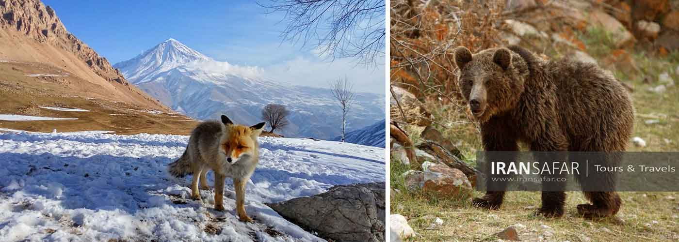
Damavand Fauna
Due to its special location, overlooking the forests from the north and the mountains bordering the desert from the south, Damavand region is home to different animal species, such as foxes, jackals, wolves, dogs ewes, ibex, boars, rabbits, and birds such as golden eagles, partridges, and quails.Sometimes these animals can be seen up to 4000 meters above Damavand Mountain, there are also few bears in this area, but they are mostly seen in the west and north. These bears usually avoid high altitudes.
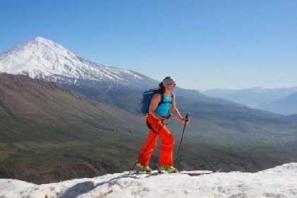
Damavand Climb
Mountaineering in Damavand dates back to thousands of years ago. Recent researches revealed that in ancient times, some people reached Damavand Peak in different ways. In Naser Khosrow‘s travelogue, it is stated that there is a well over Mt. Damavand from which ammonium chloride and sulfur, are taken. Damavand Expedition is another tourist attraction of Tehran. For the first time, Europeans climbed Damavand Peak in 1837, led by Tyler Thomson. Also, the first documented ascent of the Iranians to this peak dates back to 1857, the height of which is set at 6613 m.
In case you are interested in hiking on Damavand you can check the detailed programs as follows:
Mt. Damavand difficulty level
Elevated slopes of mount Damavand can be a bit challenging for some amateur climbers; however, is still feasible for most people with proper acclimatization and suitable gear. In general, Damavand trek is not generally a technical one and climbers in good physical shape can enjoy a great trekking up to the peak accompanied by a certified Iranian mountain guide.
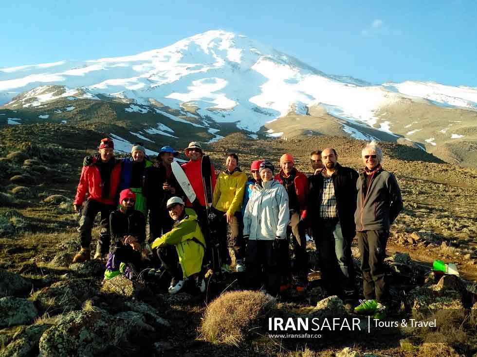
Best Time to Climb Damavand Peak
Professionals consider the best time to climb Damavand to be from mid-June to early September. At other times, reaching the summit will be difficult and dangerous.
Climbing Damavand Peak must be done with trained and professional mountaineering groups, and solo climbing would be dangerous. A layer of base clothes, polar, full coat, gloves, hat, suitable mountaineering pants, woolen socks, gaiter and a pair of mountaineering batons are needed to climb Damavand peak in summer. Of course, the group guides explain all these points to the members of the mountaineering group before moving to the peak.
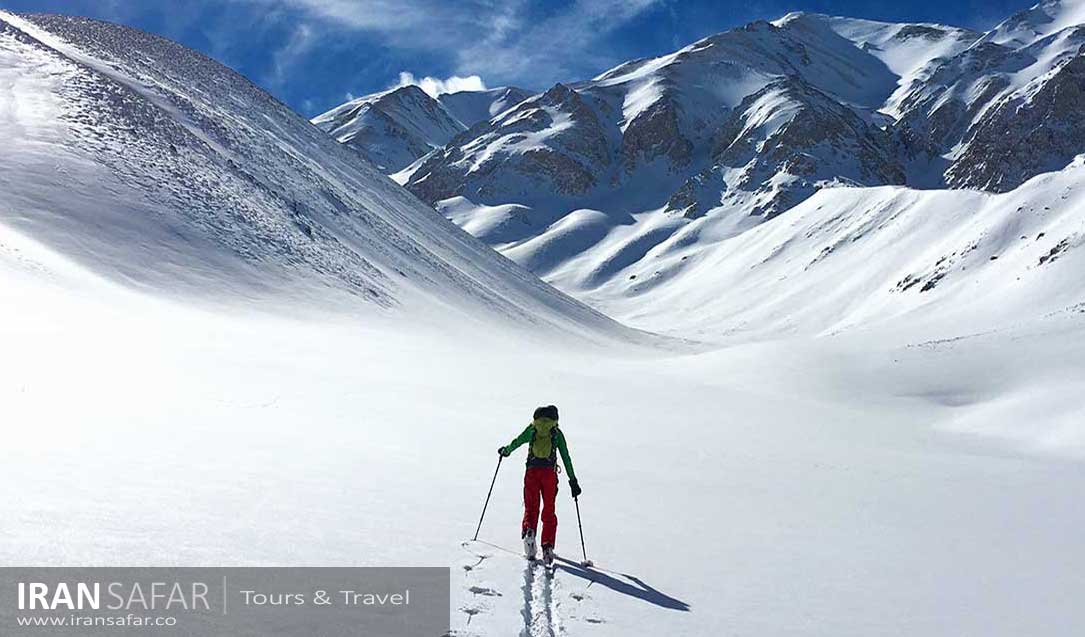
Damavand Ski Season
Damavand Ski Season is from November till mid May. It is possible to ski in winter and spring. The amount of snowfall changes each year. Because of its proximity to the Caspian Sea, Damavand benefits a great amount of snow in autumn, winter and spring. In a good snow season it is possible to ski downhill about 12 Km on mild ski-able slopes.
Damavand Base camps and Sanctuaries
Multiple base camps are available on the climbing tracks of Mt. Damavand that prepare a basic accommodation and resting area for mountaineers. The base camps and shelters are as per below:
1. Goosfandsara base camp located on the southern track – 3000 m above the sea level
2. Bargah E Sevom Sanctuary located on the southern track – 4200 m above the sea level
3. Simorgh Sanctuary located on the western track – 4200 m above the sea level
4. Chahar Hezar base camp – 4000 m above the sea level on the northern track.
5. Panj Hezar Shelter – 4600 m of above the sea level on the northern track.
6. Takht e Fereydon camp located at 4350 meters of altitude on the northeastern track.
Damavand Water Fall
With height of 7 m and a diameter of 3 m, there is a frozen waterfall on the south side of Mount Damavand that is unique in the world. It is an ice waterfall that is always frozen. At the top of this waterfall there is a pit that is covered with snow all year round. Damavand ice waterfall is located at an altitude of 5100 meters and is the highest waterfall in the Middle East in terms of height above sea level.
Glaciers of Mt. Damavand
There are 7 glaciers in Mt. Damavand that makes it more charming for trekking and climbing. These glaciers are as below:
1. Siole ( located near the northern route)
2. Dobi sel (located near the northern route)
3. Aroosak ha (located near the northern route)
4. Dareh Bokhar ( located near the northeastern route )
5. Khor Tab Sar
6. The northwestern glacier
7. The western glacier
I am planning to travel to Iran in September. I am from Sweden and plan to climb Damavand with your groups. What is the best track to climb? I am not a highly professional climber but almost experienced.
Dear Kristina,
The best time to climb Damavand is in August. You can climb this peak from four tracks: the north face, which is the most difficult route, the northeast face and the west face, considered semi-difficult, and the south face, which is the easiest path. Hope to see you soon! keep in touch